Crater Lake National Park

The drive from the green valley to the top of the mountain was beautiful.
The trees were covered with fresh snow and shimmered like tinsel on a Christmas tree.

Our first stop was the Visitor's Center. Our first indication that the average of 48 ft of snow per year was mostly still in place in mid-May.

Second stop... what looks like a port-a-potty was actually a 40 ft L-shaped tunnel to the bathroom. A real man cave!

Then...Aaah! The first glance of the stunning lake! Crater Lake is over 1900 ft deep and amazingly clear, so it is as blue as deep ocean water. The lake fills the caldera formed by the collapse of the volcano Mount Mazama only 7,700 years ago.

Then lots of picture taking!

And people offering to take pictures

Everywhere we looked...beauty!


So happy!

We found a nice rock wall to sit and eat lunch and enjoy the view

A pair of Gray Jays decided to join us

They really wanted to eat our lunch!

So pretty but so bold...he almost got a bit of our sandwich a couple of times.
Reminded us of seagulls at the beach.

So photogenic

The Lodge was due to open in a couple of days

A view of the lodge from the street. The walls of snow behind Wendy are up to 15' high.
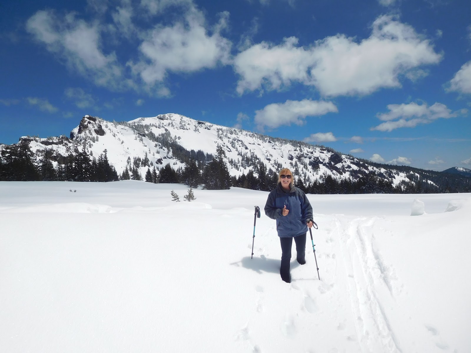
In certain places, snow shoes would've been a good idea

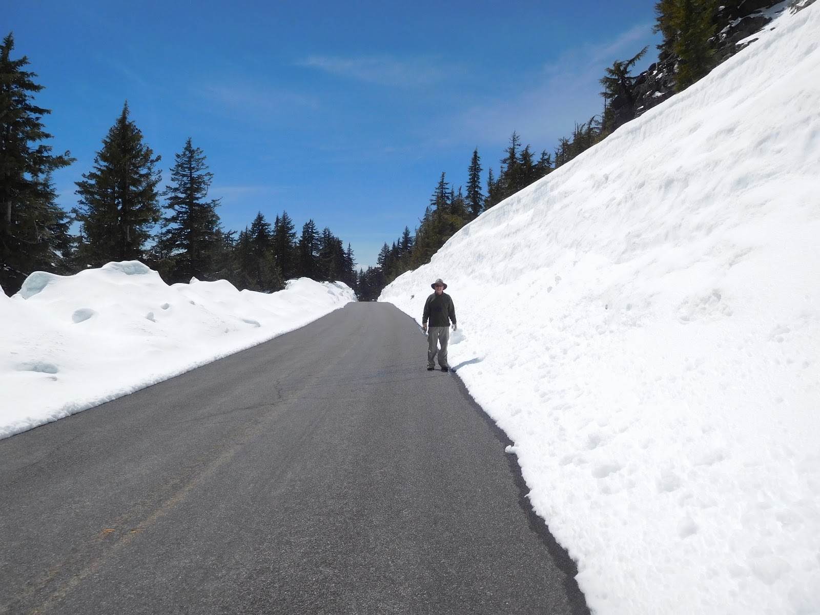
Poles marked the roads location for snow removal

Some buildings were still inaccessible in mid-May

West Rim Road... a mile or so had been cleared and was open to pedestrians only. With over 48 ft of snow this winter all the roads will not be open until July!
It was a pretty walk

Never saw so much snow in our lives!

The clearings on the walk would open up to incredible views of the lake
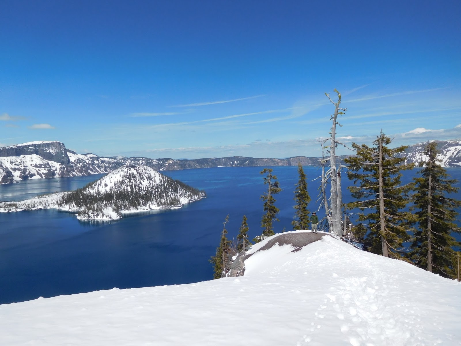
Yup, that's Dave down there on the Discovery Point overlook.

View of Wizard Island, a cinder cone formed shortly after the eruption and collapse of Mount Mazama 7,700 years ago.

Wizard Island is a 2,700 ft tall cinder cone, but only 755 ft show above the surface of the lake. The source for the majority of the water in the lake comes from the snow that falls each winter.
 This falls trail was about four blocks from our campground
Waterfalls


have to take a pic of the map so we know where we're going. :)


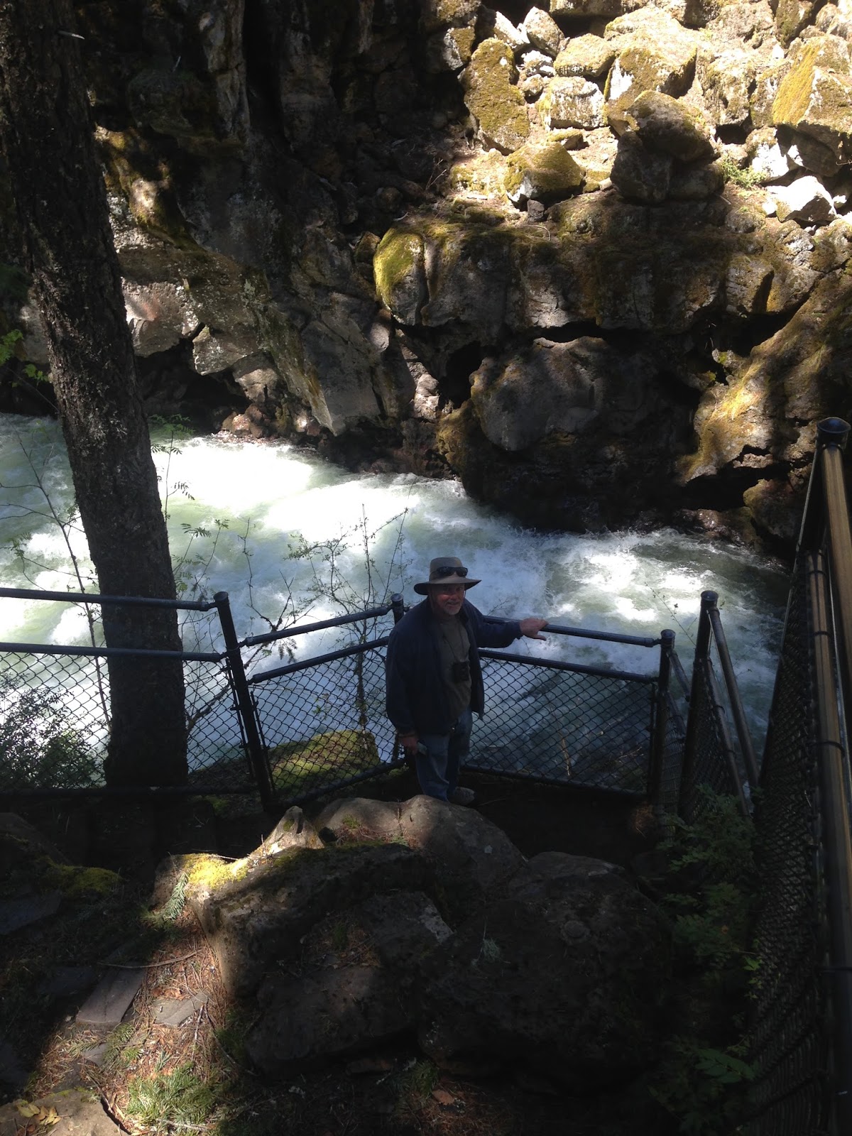
Rogue Gorge (about 11 miles upstream from Prospect, OR)


Natural Bridge

but it was closed to traffic so we parked the jeep and got on our bikes to see it.


Flounce Rock

Rogue River Valley, the Cascades (14,162 ft. Mt. Shasta was around 90 miles away!) and Lost Creek Lake


The reason we were able to get to the top via the jeep and the reception was great!


Due to the Wet & Snowy Winter/Spring Many Areas Were Closed
Drove about 30 miles to ride our bikes around Diamond Lake, but when we got to the road leading into Diamond Lake, it was covered with snow and closed to traffic. So we changed plans and headed for National Creek Falls. The road leading in had enough snow to rule out the jeep, so we got onto our bikes to see how far we could get before it was totally impassable. We had to navigate through a bit of snow at the very beginning, but then the road cleared up and we were off...
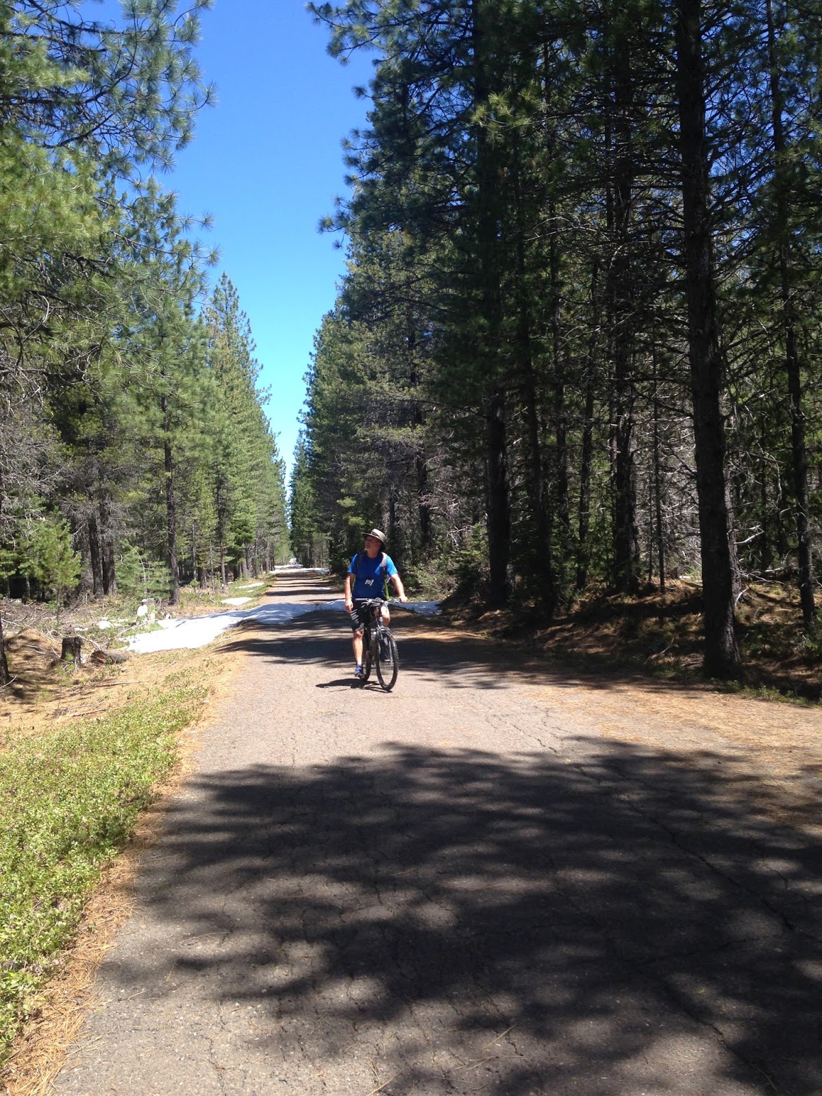
The road descends through a shaded, mixed conifer forest,
ending at the base of National Creek Falls. Fed by springs on the pumice flanks
of Mt. Mazama, National Creek flows year-round even in drought years.

Stopped at this bridge along the way to eat our lunch


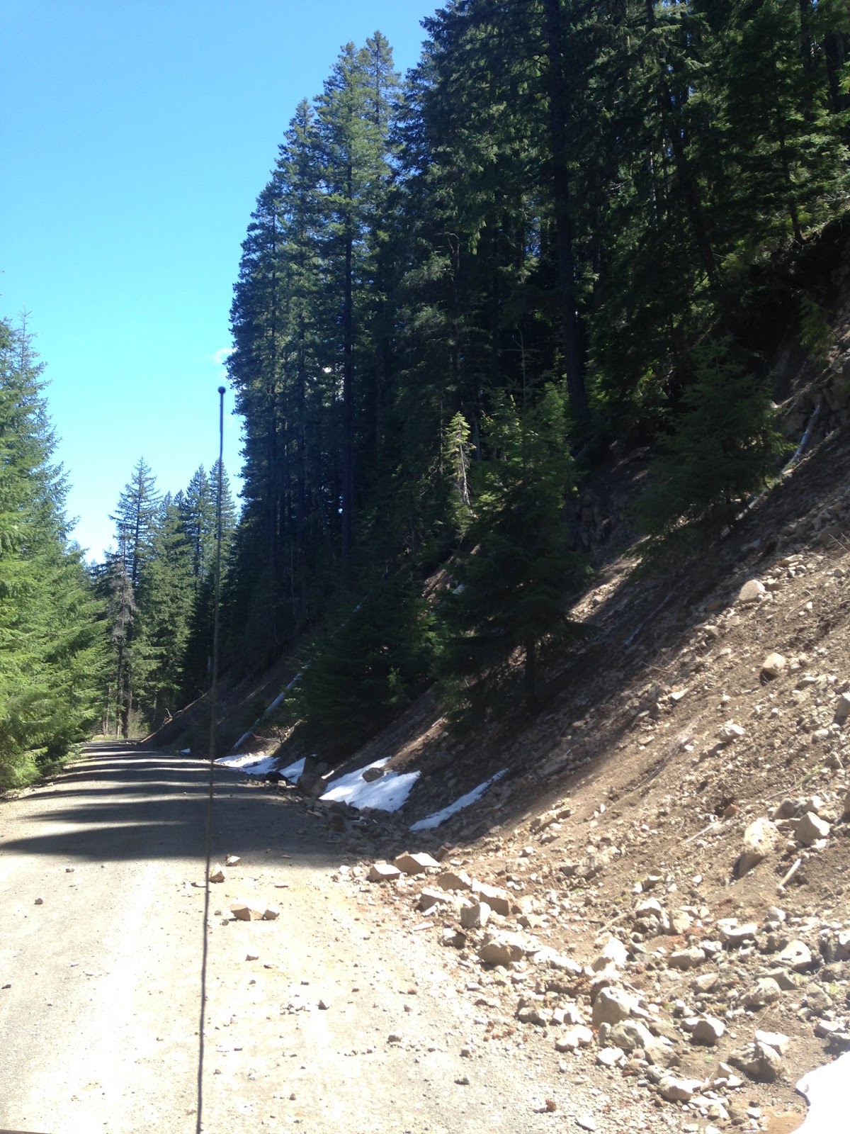
And then about a mile short of the falls, we came upon this...
deep snow as far as we could see up the road. So we turned around and went back to the jeep.
Then we tried to go to Rabbit Ears and we came upon this...
not so bad...

then this, deep snow and a tree across the road. So we turned around and headed for Joseph Stewart State Park...


Kayaking on Lost Creek Reservoir


Wendy caught one on her paddle


The pics are amazing! I can't believe how much snow was still there in the middle to end of May. Looks like you guys had quite an adventure.
ReplyDeleteThanks Randy! Crater Lake was unbelievably breathtaking! Between the beautiful blue of the lake and sky...and the SNOOOOW! It was gorgeous! On our way to Mount Hood today...still covered with snow.
Delete