We left Bryce Canyon at 9:30 for our drive to Torrey,
UT. We arrived at around 1. Most of the drive was on a scenic byway. It wasn’t
a white knuckle drive…just beautiful scenery through the Dixie National Forest.
Saw mule deer, snow, and a pretty reservoir along the way. The summit elevation
was 9600 feet.
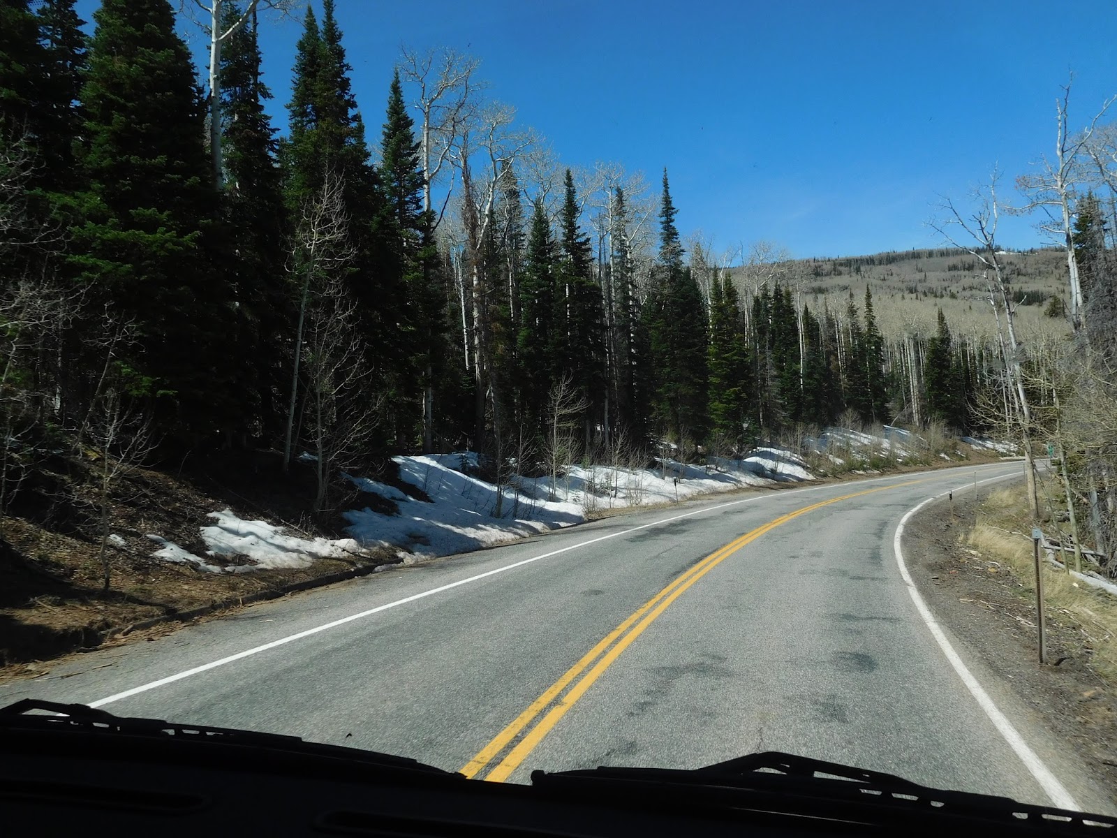
Pretty drive through Dixie National Forest

Elevation 9600

Mule Deer
We’re staying at Thousand Lakes RV Park and we really had a hard time getting into a campground in this area. So we are staying at a dry site for tonight and then moving to a water/electric site for tomorrow night.

Our campground had a view of snow capped mountains...

...and beautiful red rocks.
After we settled in at the campground, we went to the
Visitor’s Center at Capital Reef for the usual…maps and orientation movie.

Then
we drove the jeep to the furthest point in the park to hike the Capital Gorge
Trail (2.4 miles round trip). The hike through the canyon was beautiful and it
lead past petroglyphs inscribed on the cliff walls. There was a short climb on
the trail to see the “tanks”, waterholes in the otherwise dry stream bed. The tanks had tadpoles living in
the water and you could hear the adult frogs croaking nearby.

Capital Gorge Trail

Beautiful canyon views

Dave pointing out the petroglyphs

Huge walls of rock

Trail to the Tanks

It was hard to find the trail in places. If not for cairns here and there, we'd be lost.
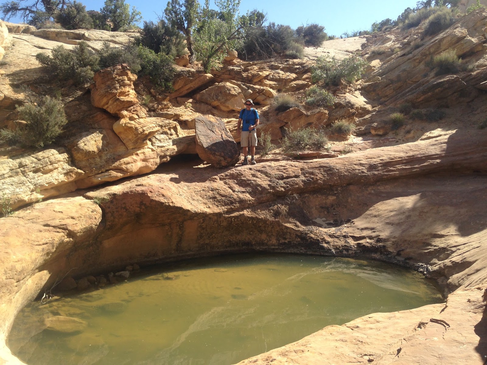
One of the tanks, 3-4 feet deep. We could see hundreds of tadpoles along the edges.

More tanks in the rocks
After that hike we drove the jeep to the Gifford House
which is now home to a museum but it was closed when we got there so we parked
in the lot and hiked the Fremont River Trail (3-mile roundtrip). As the name of
the hike suggests, we walked along the river to a steep climb up Danish Hill
for panoramas. Wendy wasn’t enjoying the steep climb up the hill, so we only
went about halfway up and then came back down.


Fremont River

Danish Hill
It was getting late, so we
headed back to the campground for dinner.
May 13, 2014
We ordered some muffins from the campground store to
pick up this morning. So Dave went and got those at 8 this morning. They
were…eh. We thought they’d be something special since they made a big deal out
of them and they were $1/muffin. We got six and they looked and tasted like
store bought mix muffins. We at least thought they’d be fresh out of the oven.
We think they made them the night before…L
Anyway, we noticed that the people who are in our
water/electric site had already left so we pulled in the slides and moved.
Once we were settled in again, we went to the NP and
hiked the Chimney Rock loop trail (3.6 mile round trip). It was a hike with a
590’ elevation gain that gave us good views of the area and the beautiful red rocks.
We finished up that hike at around 1 so went back to the RV for lunch and to
throw a pork roast into the crockpot.

The beginning of Chimney Rock trail

The chimney rock from the top of the trail. The parking area and road into the park are below.


Dave looking at a recent rock slide


This sheriff's car was parked in different places in the small town of Torrey. Not very talkative but made us laugh every time!
We headed to the NP again at around 3 and hiked the
Hickman Bridge Trail (2 miles round trip) to view the 133-foot natural bridge.
It was a hot hike and we were dying to find shade along the trail! There wasn’t
much to find. But the sweaty hike was worth it! The bridge was gorgeous!

We thought this was the bridge at first.

It was a nice place to get some shade

But it turned out we had to go a little farther to see this

Then we drove to the Petroglyph Panel to see the
ancient art carved into the Wingate sandstone. The panels include images of
anthropomorphs and bighorn sheep. Very cool!

Petroglyphs

These are harder to see, but there's a big horned sheep in this panel.
Our last stop was the old Fruita Schoolhouse, a small
one room building with the original desks, books, etc. that teachers and
students used. The teachers usually lasted only one year due to the isolation
of the location.

The Fruita Schoolhouse, in pretty good shape for being built in 1896!

Inside the schoolhouse. Dave's in the window across the room. Do you think he misses teaching?
Headed back to the campground and since they opened
the pool today…Dave took a swim and relaxed his aching legs.
We are almost caught up, look for more when we find wifi again.
We are almost caught up, look for more when we find wifi again.
Looks like fun
ReplyDeleteLooks like fun
ReplyDelete